


The Future Of Water
On a recent visit to the Mojave Desert I became fascinated by development in Yucca Valley. Why do people live here? Where do they get their water? An inquiry.

I went to the Mojave Desert on a whim back in March.
One of my best friends, PJ, had purchased tickets to see the indie pop duo Lucius perform with Dawes at Pappy + Harriet’s, a charming music venue in a fake pioneer town in the middle of the desert. In the mood for adventure, I booked a flight to visit California for a few days. Neither of us had ever been to Joshua Tree, so we decided to make a weekend of it, visit the National Park, and stay out in Yucca Valley, an unincorporated town in San Bernadino County.
It was my first adventure since taking my new role as Engagement Director with the Whidbey Environmental Action Network. For the last several months, I have been completely immersed in the world of environmental policy and ecology in Washington State — specifically Whidbey Island, where I live. I knew the learning curve would be steep and my colleagues did not disappoint. The work is challenging and important. I love it. I have been reveling in the opportunity to tackle how to communicate with the public from an environmental perspective. I’ve spent months in deep, deep learning mode (I’m still there, and might be there forever). I’m writing and podcasting a lot about what I’m learning in my role, the main reason my newsletter posts have all but dried up lately.
One of the things that I didn’t fully grasp about the environment before taking this job is that “the environment” is functionally everything all around us, all the time, and therefore, touches every aspect of our lives. Theoretically, I knew this. But diving into it head first is another matter entirely.
The Merriam-Webster general definition says the environment is “the circumstances, objects, or conditions by which one is surrounded.”
Yeah, so, like I said, basically everything.
From an ecological perspective, the environment is “the complex of physical, chemical, and biotic factors (such as climate, soil, and living things) that act upon an organism or an ecological community and ultimately determine its form and survival.” Socially, the environment is “the aggregate of social and cultural conditions that influence the life of an individual or community.”
The Western concept of “environmentalism” came to the forefront during the Enlightenment of the 1700s-1800s as a merging of the fields of natural history and medicine during a period that valued the advancement of ideas, rational thought, and science. From a white colonist perspective, Benjamin Franklin has been credited as one of America’s first “environmentalists.” In addition to his many, notable contributions as an inventor and scientist, Franklin protested waste dumping in the waterways of Philadelphia in the summer of 1739.
Of course, Indigenous peoples are the first environmentalists. Indigenous lifeways have had a deep understanding of the environment for centuries. In current scientific circles, the inclusion of Indigenous data in research is called traditional ecological knowledge, a cumulative body of knowledge and practice derived from direct contact with the environment.
Within the modern Western definition, environmental science can be broken down into the following basic branches of subject matter expertise: ecology, geology, meteorology, biology, chemistry, engineering, and physics.
Environmentalism is a mix of all these things in one way or another, based on how time, space, elements, organisms, physics, and whatever else interact in the circumstances, objects, and conditions we are surrounded by at any given time. As a child of the 90s, my understanding of the environment was developed in more simplistic, nostalgic terms into the following categories by the infinitely wise and cool Captain Planet: earth, wind, fire, water — and heart.
All of the branches of environmental science cover the first four elements in some way. However, the concept of heart has somehow been left out of most STEM curricula and Western society’s understanding of environmental policy and research science. How does love factor into our relationship with the natural world? What are the physics of a heart-centered approach to the earth? What is the geography of our emotional relationship to the landscape? What is the chemistry of our ethereal bond to the planet?
I wonder.
PJ and I woke up early and headed East from his apartment in West Hollywood toward the desert. We listened to Lucius albums on repeat during the two-and-a-half hour drive as we sat in traffic on Highway 10, through the terrifying blades of the San Gorgonio Pass windmill farm just past the Cabazon Dinosaurs, until the mouth of the Mojave opened up when we turned off the 10 in Palm Springs.
“Dusty trails can lead you to a golden road, I’ve been told” our favorite girlie pop duo belted out as we rolled through the shabby desert towns on Route 62, dubbed “the most desolate highway in California.”
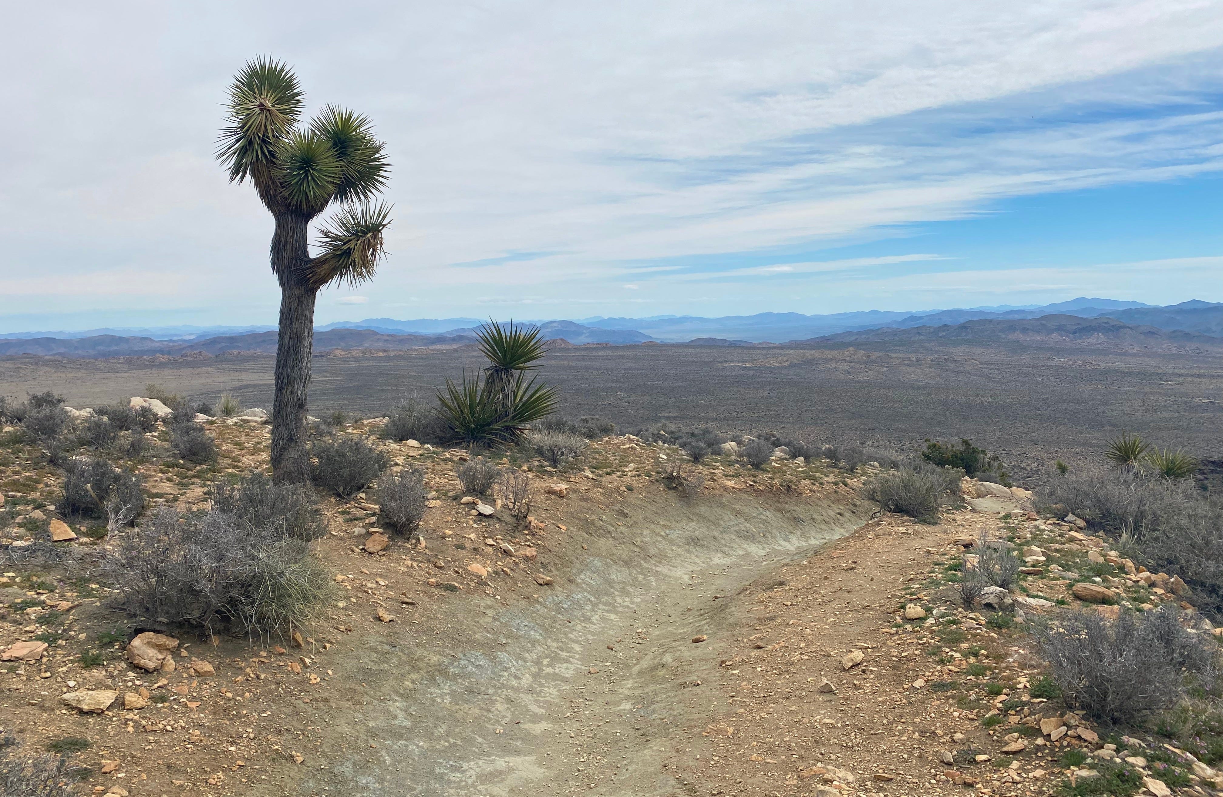
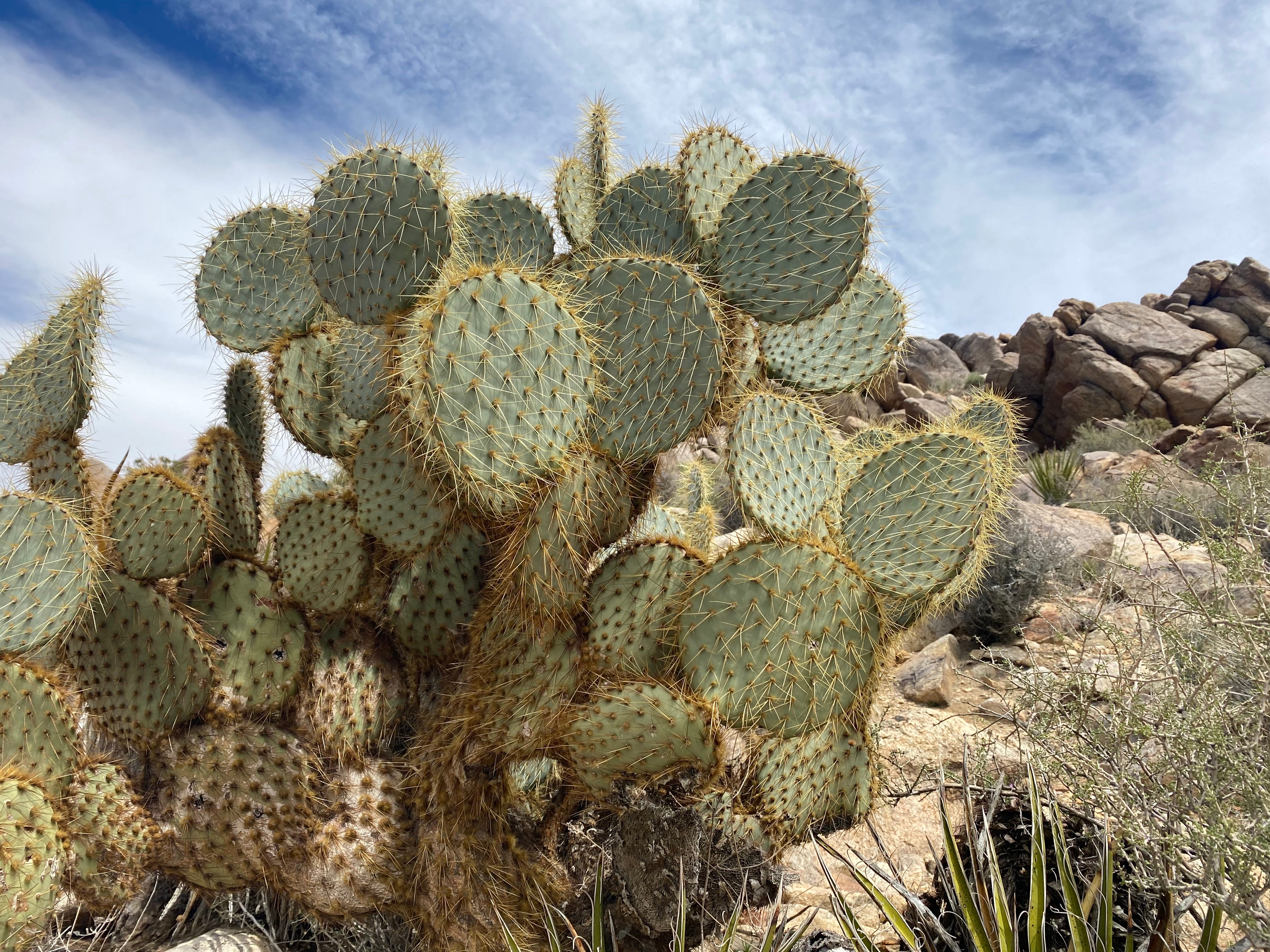
PJ and I arrived at the gates of Joshua Tree just before noon. After orienting ourselves to the park, PJ and I approached the base of Adam Mountain, which looked less like a ‘mountain’ and more like a giant mound of sand and rock speckled with cacti. By the way, I love cacti. There is something so wise about a plant that guards its limited water resources with an “offense is the best defense” approach. If you lived in a place with almost no rainfall, to survive you would hold on to every single drop of water you received from the sky, and guard it with your life. For cacti, this comes in the adaptive form of spines, which are actually modified leaves that protect cacti from thirsty herbivores and facilitate rain collection for the plant. In other climates, plants don’t have this particular adaptation because water is usually more plentiful. If an animal eats the leaves of a plant, more rain will fall, the sun will shine, and more leaves will grow. Not here. A cactus says, pierce or be pierced.
Without a raindrop in sight, what other options would you have?
The path up the mountainside was deceptively long and steep. The wind whipped wildly and unexpectedly up the cliffside. The sun was fierce. I kept having to take my jacket off and put it back on to regulate my body temperature. When we reached the top, my heart pounding, the sun won out and I took off my jacket to survey the landscape. We took an obligatory selfie with the summit sign. Then we settled on a pile of rocks near the summit and ate our packed sandwiches, sipping gratefully on water from our metal canteens. Between bites of my turkey-lettuce-tomato-on-rye, I imagined what it might have been like to be a pioneer settler traversing this landscape with my family in a covered wagon. It must have been awful. I took a swig of cool water from my bottle. My tongue searched for the last drops. Then, I sat and looked out at the expanse.
There was nothing but desert for miles and miles and miles.
The legend of how the Joshua Tree got its name, a plant known in scientific taxonomy as Yucca brevifolia Engelm — a yucca in the agave family and not a tree at all — comes from Mormon settlers crossing the desert in the late 1800s. Hallucinating under the rays of relentless sun, the settlers thought these agaves looked like the biblical Joshua, with his arms outstretched to the sky toward God.
They must have been very dehydrated.
“What if you were out here without water?” I asked PJ. “How would you access it?”
Ever the pragmatist, PJ pointed at a flowering teddy bear cholla cactus nearby and replied “I’d take the biggest rock I could find and I would smash one of them at the base until I hit flesh.”
A metaphor for how Western humans approach resource management. We find, we smash, we use, we discard. Repeat. And if I was desperately thirsty in the desert, I would do exactly that. Smash, use, and discard. On to the next.
Without a raindrop in sight, what other options would you have?
The human body needs water to regulate our internal body temperature. Water acts as a building material for every cell in the human body. Carbohydrates and proteins that our bodies use as food are metabolized and transported by water in the bloodstream. Water helps us flush waste, acts as a shock absorber for our brain, forms saliva, and lubricates our joints. On average, a person must drink between 2.2-3 liters of water daily to keep all of our biological functioning.
In short, we cannot live without water.
I wondered how many cacti I would have to smash a day to reach that goal in these conditions. It would depend on the size and species of cactus, I guess. The Saguaro cactus, for example, a species native to the Sonoran desert, can grow up to 40 feet tall and can hold up to 1,000 gallons of water at a time. That is approximately 3,785 liters of water. Without considering water lost to evaporation, a single Saguaro at that capacity could satiate me for almost five years. Except for one thing — cacti have brilliantly evolved to further protect themselves from being devoured by the likes of us. Despite the raw water potential of a cactus, humans can’t consume large quantities of cactus water. The acids in the inner flesh of a cactus make us vomit and have violent diarrhea, which causes further dehydration.
So much for that survival strategy.
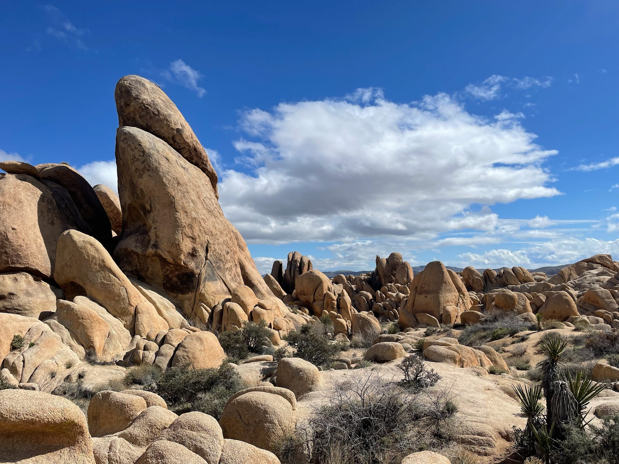
Joshua Tree looks like you’ve landed on Mars. The rocks, cactus, and other vegetation are otherworldly. It’s kind of shocking that human beings can breathe the air here. It feels like visiting the bottom of an ocean that has been sucked dry by time (because maybe it has). Conventional wisdom suggests that the very first rock formations at Joshua Tree are 1.4 to 1.7 billion-year-old metamorphic rocks, the oldest of which is called the Augen Gneiss. The USGS says these rocks were initially intrusions of magma that formed into igneous rock. Visually, that makes sense. They kind of look like blobs of plaster painted to replicate space rocks on an alien movie set. One theory about the geological origins of Joshua Tree postulates that 800 million years ago when North America broke off from Rodinia and drifted toward the equator, Joshua Tree ended up underwater as part of an offshore continental shelf. As we wandered around the park, I imagined us walking on the floor of an ancient ocean, every little succulent actually a terrestrial sea urchin, every cactus coral on dryland, and PJ and I, creatures of the deep.
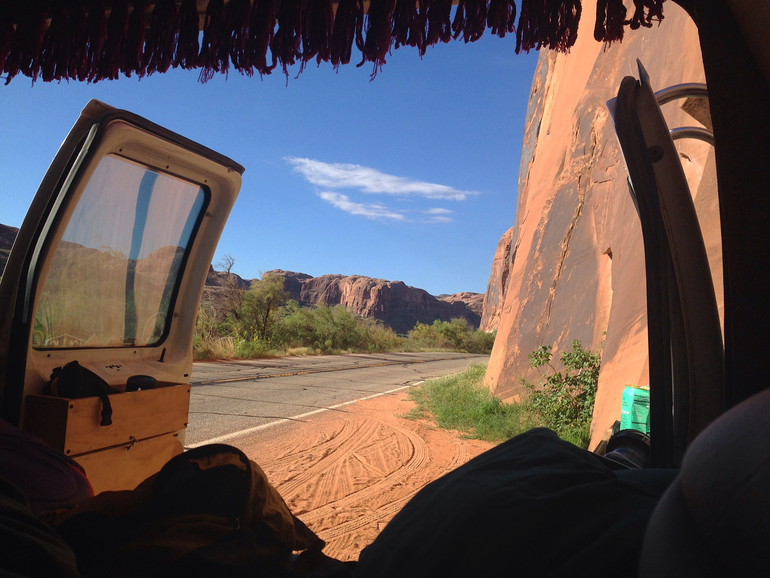
I first fell in love with desert landscapes while traveling through the red rocks of Utah and Arizona on a cross-country road trip with a group of friends on what we called “The Snackmaster’s World Tour.” It was then, in a converted police surveillance van full of filthy (lovely!) punk boys, that I first encountered the majesty of Zion, the charm of Moab, and the mystical vibes of the Arizona desert. Unlike the washed-out gneiss of Joshua Tree, the red rocks of the Southwest appear fertile and decadent, a lush tapestry of deep, iron-rich pigments. Based on the stark geological differences, I was surprised to learn that Joshua Tree and Zion are technically in the same desert, the Mojave, though Zion intersects with three distinct ecosystems: the Mojave Desert, the Colorado Plateau, and the Great Basin.
I was also surprised to learn there are four major deserts in the U.S. — the Great Basin, Mohave, Chihuahuan, and Sonoran — each comprised of vastly different ecosystems with distinct geological characteristics and specially adapted flora and fauna. But they all share common ecological traits: they have both arid climates and a distinct lack of water. By definition, a desert is an arid ecosystem that receives less than 10 inches of rainfall a year.
After checking out the various desert oddities in the park, including an expansive field of elegant cholla cacti, PJ and I rambled around the neighboring little desert towns looking for interesting thrifting treasures to bring back from our trip. Among other things, PJ was in the market for a leather jacket.
We hit every major town in the area: Joshua Tree, Yucca Valley, 29 Palms, Palm Desert, and Palm Springs. At an eclectic vintage shop in Yucca Valley called The End, I found a beautiful Pendelton Chief Joseph blanket from the 1940s. The classic geometric arrowhead pattern was woven with a brilliant green of cactus, tan and gray layers of gneiss, and a combination of deep red, orange, and yellow reminiscent of the setting of the desert sun. I bought it.
Of all of the developed areas in the desert, Palm Springs was the visual anomaly, boasting oasis-level water use facilitating gorgeous hedgerows of bright fuschia Bougainvillea, large swimming pools, turfed football fields, and lush landscaping like there was a plentiful water source nearby. Despite the obvious limitations of the landscape, somehow Palm Springs seemed wealthy with water. Elsewhere in the desert, towns like 29 Palms and Yucca Valley, sport a more familiar desert landscape — sand and cacti for miles, dusty and waterless.
Shockingly, along Highway 62 there were tons of “for sale” signs on empty lots surrounded by the dry nothingness. Don’t get me wrong, I loved the weirdo vibes of the desert towns. This was a place where people could be open about their belief in UFOs. Or, I don’t know, have an exotic snake farm and be totally accepted by the neighbors. There was a shop on the highway where I could buy both crystals and wine. Ideal. But I was shocked and appalled by the speculative development in the literal middle of nowhere. New developments, mind you. Lot after lot of land with active “for sale” signs spiked in the dunes with no hope of shade. And certainly no water.
Why are people buying lots out here? How on earth do they get their water? Do people still think that rain actually follows the plow?
Something did not compute. Cacti may have adapted to this harsh environment, but humans? No way. We need water for hot showers, our dishwashers, and our above-ground pools, not to mention our basic biological functions. On the surface, the immediate landscape did not support this kind of need.
“Why do people live out here?” I mumbled to myself. “It makes no sense.”
On our way back into Yucca Valley, we passed the Hi-Desert Water District on 29 Palms Highway. I was tempted to drop in and ask them about their water systems, but PJ vetoed the idea.
“You’re on vacation. Give it a rest.”
Okay, PJ. Easy for you to say. I guess you’re not constantly, obsessively ruminating about the state of the world’s water. I didn’t insist on the detour, but I did do some research back at our Airbnb because I needed to understand where the residents of Yucca Valley and Palm Springs were getting their water.
Here’s what I learned:
Palm Springs is part of the Coachella Valley Water District, formed as a special water district in 1918, which covers 1,000 square miles and serves a population of 320,000. CVWD gets water from three primary sources: groundwater, recycled water, and imported water. The groundwater comes from an aquifer beneath the valley extending from northwest Palm Springs to the long-suffering Salton Sea. The “imported water” comes primarily from the Colorado River, which travels 122 miles from the river to the valley through the concrete-lined Coachella Canal. Recycled water is used to maintain landscaping, like the pretty hedgerows of Bougainvillea.
The Hi-Desert Water District was founded as a special district in 1962 to provide water to the growing population of Yucca Valley. According to their website, the water district serves more than 11,000 active water service connections in a 57-square-mile service area and operates 16 storage tanks, 13 wells, and maintains more than 312 miles of pipeline.
I was astounded to learn that Coachella and the Hi-Desert were getting water from the ground. If a desert ecosystem only receives an average of 10 inches of rainfall a year, how long does it take for groundwater to accumulate? And with a projected increase in population, how long will it take to dry up? The basic math of extraction and replenishment doesn’t add up.
Water is the foundation of life. It is also a finite resource. As the landscape and ecosystems of our world rapidly shift as a result of climate change, some places are becoming desert at an alarming rate. According to a UN report on desertification from 2020, water scarcity currently affects between 1-2 billion people, most of whom are in what the UN calls “drylands.”
“Under the climate change scenario,” the report reads, “nearly half of the world's population in 2030 will live in areas of high water stress. In some arid and semi-arid areas, it will displace up to between 24 million and 700 million people.”
This tracks.
The American Southwest has been experiencing a drought for the last 22 years worse than any drought in the last 1,200 years. The Colorado River is in a major drought crisis due to the effects of climate change and overallocation. Water is evaporating and snowpack is melting more quickly due to rising temperatures. The Salton Sea, a lake formed by an overflow of the Colorado River in 1905 and replenished by agricultural runoff throughout the 20th century, is rapidly shrinking. This November, all but two states in the U.S. experienced drought.
In his autobiography, Benjamin Franklin observes: “When the well is dry, we know the value of water.” By his measurements, I fear we are about to know the value of water very soon.
A couple of months ago I went backpacking for the first time in the backcountry of the Olympic Mountains and got to see snowpack up close and personal. As we climbed in elevation, water cascaded down the mountainside, sometimes in the rush of a fast creek, sometimes in the trickle of a small stream nestled between sun-seeking needles and vivacious little purple wildflowers, Primula hendersonii, shaped like little stars. After about eight miles, the Royal Basin trail opens up into a delightful alpine meadow decorated with moss heather and alpine lilies. There you see her for the first time, Mount Deception, covered partially in glacial ice. She was beautiful to behold, but she was not dressed in nearly as much snow as I had been anticipating. To be frank, she looked half-naked. I felt a little uncomfortable taking her picture.
This year, the snowpack in Washington was 71% of the expected snow, leading the Department of Ecology to declare a statewide drought emergency in April. On the island I live on we, like the people of Yucca Valley, rely upon groundwater for our potable water. With insufficient well monitoring and an increase in population, there are serious concerns about the capacity of our sole-source aquifer and the dangers of saltwater intrusion. Meanwhile, people are migrating north from states like Texas and California to escape drought, extreme heat, increased storms, and wildfires.
A flamingo, I’m told, has been spotted in Cape Cod, Massachusetts.
It has always been the hubris of Western man to believe that he is greater than the environment. That he can build and design his way into conquering the landscape. Nature adapts through gradual evolution over long periods, modern humans take nature (and everything, it seems) by brute force now. Which always, and I mean always, bites us in the ass. The Earth will ultimately win. But, will we ever learn?
I wonder.
PJ and I spent our last night in Pioneertown for the concert. Built as a stage for classic Westerns in the 1940s, the town exists entirely as a fabrication of the American imagination of the pioneering West. This little town was the set of The Cisco Kid franchise. In more recent memory, Pioneertown was the scenic backdrop in Lil Nas X’s movie for the hit single, “Old Town Road.” There is a main drag, a “saloon,” a shop with fancy soaps and overpriced Filson shirts, and a little museum outfitted with dusty, old movie posters and a video on loop. And of course, Pappy + Harriet’s. The Lucius/Dawes concert was deeply intimate and magnetic, the perfect show to see outdoors with the backdrop of the setting sun. We were so close we could see beads of sweat drop onto the stage.
Lucius and Dawes performing “Mad Love” at Pappy + Harriet’s in March 2024. Video by earthbyapril915.
In the wee hours of the next morning, as PJ and I drove on Highway 62 toward LA, we watched a full moon set over the indigo mountains to the West while the scarlet sun rose over the hills to the East in a dramatic, soulful dance between the rising of day and tucking in of night. The desert was so quiet you could hear a pin drop a mile away. The moon was gigantic — luminary, mystical, and luscious in full view. The moonlight cast silhouettes on the Joshua trees sprawling across the landscape. In that moment the magic and charm of the desert were laid bare for me in full display across the naked, purple expanse. My heart was wide open to the divine majesty of the cosmic transition, completely consumed by the ancient ritual of the sky.
I finally understood. They love this place.
“Mad Love,” sang our favorite girlie pop duo in perfect harmony on the radio in the dashboard of the fading moonlight, “spinning around like a carousel in a storm. Slow it down. Suddenly here I’m falling, like falling in love again…”
“I see why people live here,” I admitted to PJ as we cruised along the empty highway, both admiring the moon with wonder. “Look at that moon, look at that expanse.”
“Mad love, spinning around like a carousel in a storm
Slow it down. Suddenly here I’m falling,
like falling in love again…”
I see why people live here. And why they won’t be able to much longer.
Without a raindrop in sight, what other options would you have?
Lucius performing “Dusty Trails” with Brandi Carlile at Newport Folk Festival